Dinnington: Postcode NE13 7LQ
Where is it? || Bing map || Geograph grid ref NZ2073 || Ward profile || StreetCheck
- Dinnington 2015-2020 and beyond (sub page)

“Dinnington is a medium sized village, with a population of 1,636 (Census 2011) living in 720 households within the Dinnington Parish. The village has a reasonable level of services and facilities, including Dinnington Village Primary School (First School), a convenience store, doctor’s surgery, village hall, social club, church, recreation ground and a regular bus service…” EXAD49, Newcastle City Council summary – Dinnington; no longer online (was listed in CSUCP library core strategy plan)
Dinnington is now a village under pressure because it is likely that almost 350 households will have been added to the 2011 total of 720 by 2025 – an increase of 48%.
- For 21st Century change see: Dinnington 2015-2020 and beyond
An examination of the village’s history shows this is an unprecedented expansion.
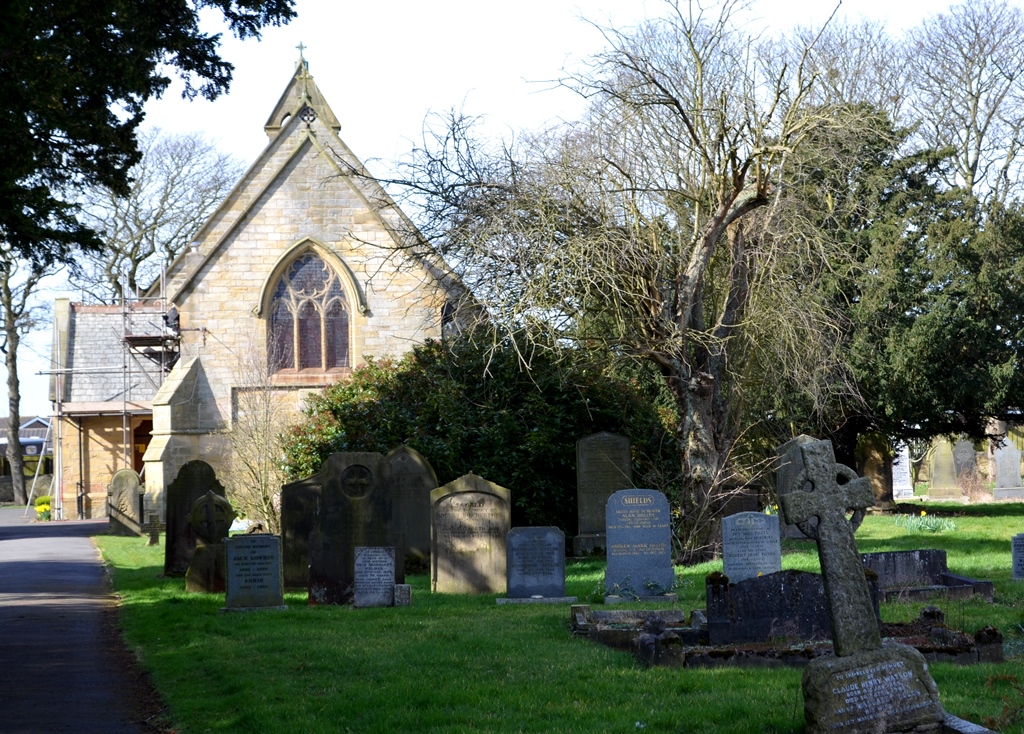
Dinnington up to 1900
According to Tyne & Wear’s Site Lines, the medieval village of Dinnington was established by 1250. There were six taxpayers there in 1296 and records from 1303 show that 11 men held a house with 1.5 acres arable. In the mid 1400s the manor was sold to the Heselrigg family, and sold again to Matthew Bell in 1763. The Bell family of Woolsington built St Matthew’s Church (1886), replacing an earlier church, and the nineteenth-century parish school.
“In the 18th century the village consisted of two rows of dwellings, set far apart, on either side of a green, with the east end of the green by this time largely closed off and partly covered by buildings.” History of Dinnington, Site Lines, Tyne & Wear
Historian Michael Barke describes rural housing conditions in the early 1800s as very poor. Most dwellings were single-storey and poorly constructed, families were overcrowded and tenancies at the whim of their landlords [‘Rural Housing in Early Nineteenth-Century Northumberland’, Int. Jnl. Regional & Local Studies, 2010, 6:1]. This helps to explain why few remaining ordinary dwellings from before 1850 are to be found in Dinnington. Early Census returns show Dinnington parish population varying from 560 in 1801 to 819 in 1831 after which it declined to 668 in 1851 [Genuki].
The population continued to fall to a low just below below 300 in 1900, but recovered rapidly to reach 1,000 in the early years of the twentieth century and was over 1,500 by 1961 [A Vision of Britain through Time, GB Historical GIS / Univ. of Portsmouth, population graph Dinnington Tn/AP/CP] The reason for this lay with the expansion of coal mining in the area.

Twentieth-century residential development

Today Dinnington still has a recognisable village centre with a green, shop, church and a traditional pub (The Mason’s Arms). However, Dinnington grew enormously during the twentieth century, particularly in the post-war period from 1945. On the eve of the outbreak of the First World War (1914-18), Dinnington was still basically a few streets and a scattering of other buildings. The village largely expanded in a series of planned estates, although some incremental individual building also took place infilling the older part of the village.


Local authority development began in the 1920s. An early 1950s OS map shows ribbon development took place along the main road into the village from the south and on the Havannah estate. This estate, to the south of the church and original school, appears to be post-war housing built for rent (c.1940-60 either National Coal Board or local authority in origin).

One council estate is the Trees Estate because each street was named after a type of tree (as found in early Garden City style developments; this estate is not on the 1954 OS map but does appear in 1961). Many of these houses have been bought under right to buy legislation and are now owner-occupied. Some housing surrounding this appears to be later (e.g. Beech Avenue, Elm Avenue 1960-70).

The Mitford Way area of the village developed between 1960 and 1980 and is a typical suburban zone of private housing (detached, semis and bungalows) with private gardens and parking. West and East Acres, north of the Trees Estate, is made up of similar private housing dating from around the 1970s.
- Newcastle Character Assessment gives an assessment of the village’s ‘sense of place’; Dinnington Zone D (pdf) areas D274, D275 and D276 with images (report undated, map from Nov 2017). Note that the scoring system is subjective.
Making a living
The local economy was historically dominated by farming, quarrying and mining coal. Early mining took the form of of bell pits; the first Dinnington colliery was operational by 1715.
In part the continual residential growth of Dinnington can be connected to the growth of coal mining locally after 1900, nationalisation of coal mining in 1947 and local investment in the mines. A 1951 map shows local pits included East Walbottle and Prestwick. Robert Pit shaft, shown on the 1913 OS map, closed in 1966 and was owned by East Walbottle Coal Company until taken over by the National Coal Board (1947).
The largest pit locally was Dinnington Colliery, now Brunswick village, where a deep mine was sunk in 1867 (Augusta Pit) and at its peak was said to have employed over a thousand people; it closed in February 1960. Big Waters lake, a subsidence pond created as a result of past mining activity, now adds to the ecological value of the area and provides a local wildlife reserve to visit (Northumberland Wildlife Trust).
Havannah Colliery was a smaller drift mine opened by the National Coal Board in the early 1950s and gave employment to around 450 people. It was abandoned in September 1977. The pit heaps were landscaped and form the Havannah and Three Hills nature reserve. Some former colliery buildings were turned into industrial workshops.
A second residential growth spurt seems to have followed the closure of those mines as the semi-rural village became a commuter dormitory for people employed in Newcastle from the 1970s, a period when both home ownership and car ownership grew.
Open cast coal mining still takes place in the vicinity. Banks’ Brenkley Lane mine opened in 2010 after the company was given permission to extract coal in a scheme lasting up to twelve years [Geograph photo 2011]. According to an article in The Chronicle in 2014 the company employed around 200 people in local mines adding an estimated £35m a year to the region’s economy (13 May 2014). The Brenkley site extends to 244 hectares or around 603 acres, and the company expect to have extracted 3.4 million tonnes of coal and about 200,000 tonnes of fireclay by the time the area is worked out in 2021. A voluntary 10 pence per tonne benefits fund has benefited local groups [Banks Mining 2018 pdf]. Banks Mining have worked on the Blagdon Estate since the mid-1970s and restore mined land to a combination of agricultural, amenity and nature conservation uses.
- For 21st Century change see: Dinnington 2015-2020 and beyond and Pressure on the Green Belt
References
- Dinnington Parish Council – see newsletter and minutes. http://www.spanglefish.com/dinnington/ Parish document library http://www.spanglefish.com/dinnington/library.asp
- History of Dinnington – farming, coal mining and notable buildings http://www.spanglefish.com/dinnington/index.asp?pageid=650844
- Photos of Dinnington, including historical: https://co-curate.ncl.ac.uk/dinnington/
- Jennifer Morrison, Tyne & Wear archaeologist History of Dinnington, Site Lines, Tyne & Wear
- NLS OS maps for England and Wales 1842-1952 http://maps.nls.uk/os/6inch-england-and-wales/index.html
- Newcastle Character Assessment gives an assessment of the village’s ‘sense of place’; Dinnington Zone D (pdf) areas D274, D275 and D276 with images (report undated, map from Nov 2017). Note that the scoring system is subjective.

I lived in the Village for the first 24 years of my life.
And can truly recommend it.